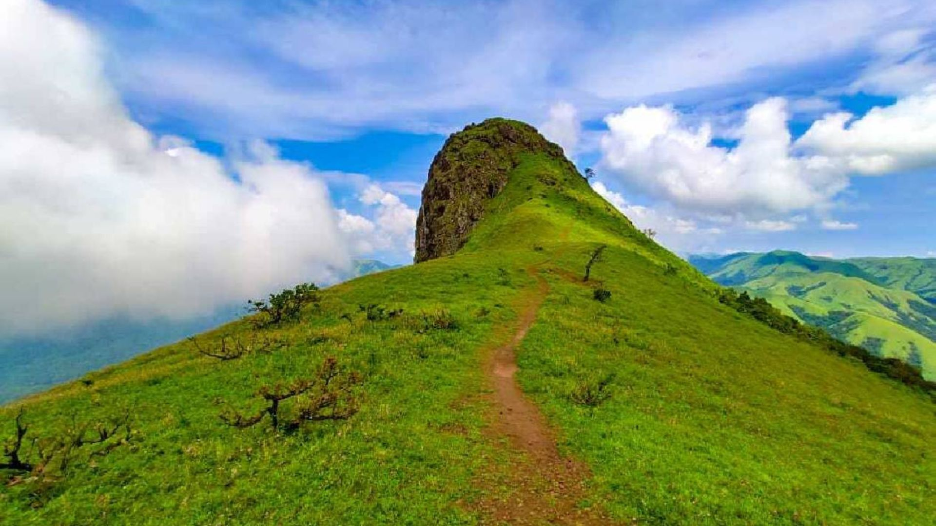


Nishani Motte Trek: A Hidden Ridge Walk Through the Misty Forests of Coorg
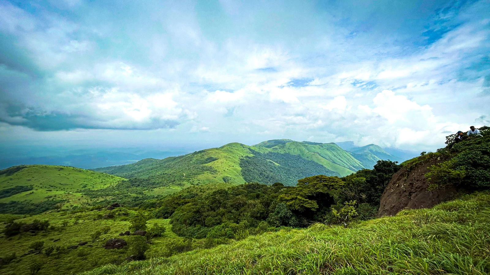
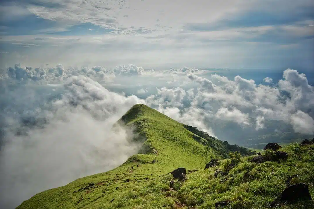
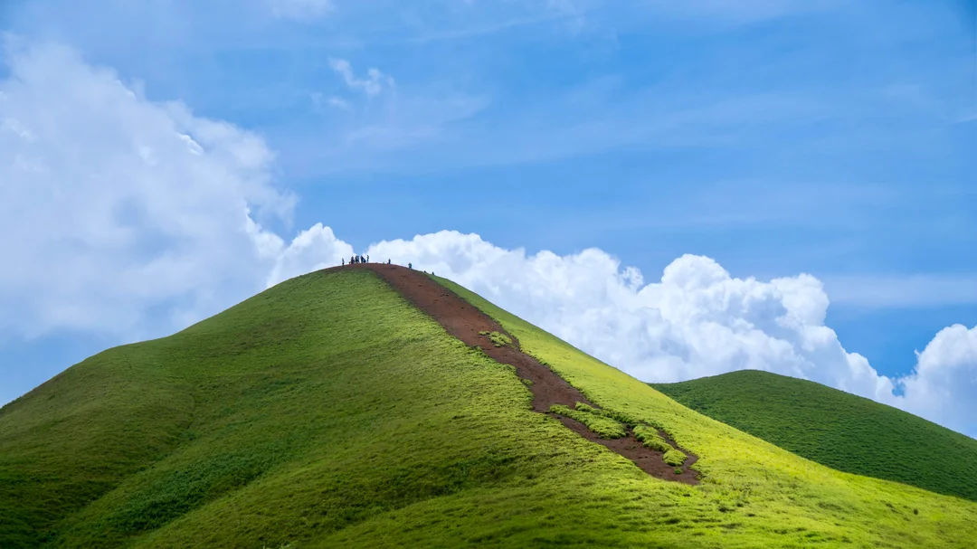
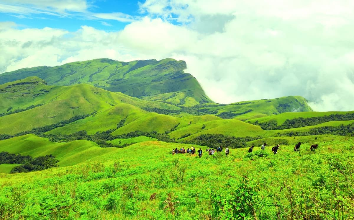
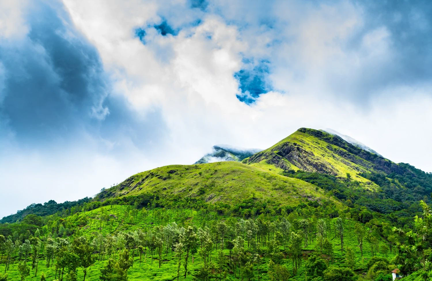
Nishani Motte Trek is one of the most scenic and lesser-explored trekking routes in Karnataka's Kodagu district. Nestled within the lush landscapes of the Western Ghats, this trek offers a perfect combination of dense shola forests, rolling grasslands, mist-covered ridges, and panoramic mountain views. Unlike some of the more crowded trekking destinations in South India, Nishani Motte remains relatively untouched, making it an ideal choice for trekkers seeking solitude and an immersive wilderness experience. The trek begins near Tala Cauvery, the sacred origin of the River Cauvery, and gradually ascends through protected forest areas before reaching the summit ridge. Standing at approximately 1,270 meters above sea level, Nishani Motte may not be among the tallest peaks in the Western Ghats, but it is undoubtedly one of the most rewarding. The route traverses landscapes that are rich in biodiversity and ecological significance. Trekkers encounter evergreen forests, bamboo groves, grass-covered slopes, and breathtaking viewpoints overlooking the valleys of Coorg. During the monsoon and post-monsoon seasons, clouds frequently roll across the ridges, creating dramatic scenery that has made the trek increasingly popular among photographers and nature enthusiasts.
A Journey Through the Forests of Brahmagiri
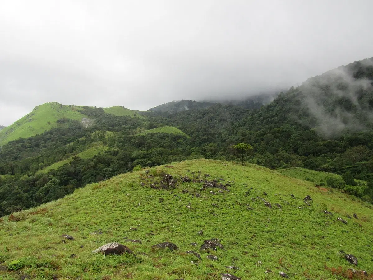
One of the defining features of the Nishani Motte Trek is its location within the Brahmagiri landscape, a region known for its dense forests and ecological importance. The trail passes through thick vegetation where towering trees create a natural canopy overhead. The sounds of birds, insects, and flowing streams accompany trekkers throughout the journey. Several sections of the route involve walking through forest paths that feel completely isolated from civilization. The forest ecosystem supports numerous species of flora and fauna, making the trek particularly appealing to wildlife enthusiasts and birdwatchers.
Spectacular Ridge Walks and Mountain Views
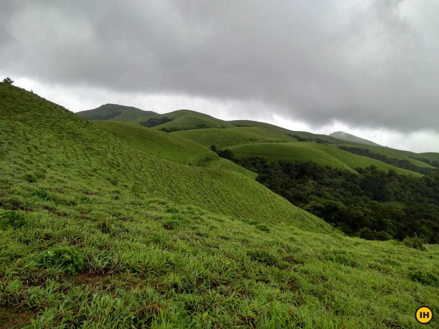
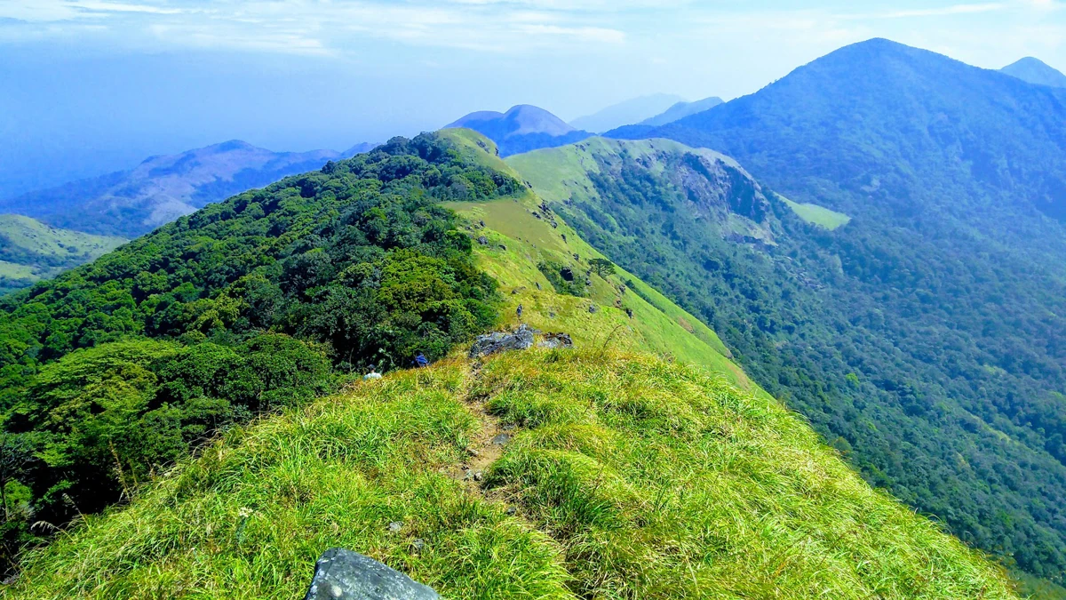
After emerging from the forests, trekkers are greeted by expansive grasslands and ridgelines that offer uninterrupted views of the Western Ghats. The ridge walk leading toward Nishani Motte is widely considered the highlight of the trek. On clear days, the surrounding mountains stretch endlessly across the horizon, while valleys and forests spread out below. The contrast between dark green forests and open grassy slopes creates a dramatic landscape unique to this part of Karnataka. Sunrise and sunset often transform the scenery into a spectacular display of colors, rewarding those who spend time appreciating the mountain environment.
Wildlife and Biodiversity of the Western Ghats
The Western Ghats are recognized as one of the world's biodiversity hotspots, and Nishani Motte lies within this ecologically rich region. Trekkers may encounter various bird species, butterflies, and signs of larger mammals that inhabit the surrounding forests. The area supports a diverse range of plant species, including many endemic varieties found only in the Western Ghats. During the monsoon months, the landscape becomes especially vibrant as streams swell and vegetation flourishes. Responsible trekking practices are important in maintaining the ecological integrity of this sensitive environment.
Best Time to Visit and Trek Preparation
The best time to undertake the Nishani Motte Trek is between October and February when weather conditions remain pleasant and visibility is generally excellent. Post-monsoon greenery adds exceptional beauty to the landscape, while winter mornings provide crisp views of the surrounding hills. The trek is considered moderate due to its distance and varied terrain. Proper trekking shoes, rain protection, adequate hydration, and warm clothing for cooler mornings are recommended. Since the trek passes through forest areas that require permissions, trekkers should ensure all necessary arrangements are completed before arrival. With proper preparation, Nishani Motte offers one of the most memorable trekking experiences in Coorg.