


Kumara Parvatha Trek: Karnataka's Ultimate Test of Endurance and Wilderness
Kumara Parvatha Trek is widely regarded as the most challenging and rewarding trekking experience in Karnataka. Located within the Pushpagiri Wildlife Sanctuary in the Western Ghats, this iconic trek attracts adventure enthusiasts from across India who seek a demanding climb through dense forests, rolling grasslands, rocky ridges, and breathtaking mountain landscapes. Rising to an elevation of approximately 1,712 meters above sea level, Kumara Parvatha is the second-highest peak in Karnataka and offers one of the finest summit experiences in South India. The trek begins from Kukke Subramanya, a famous pilgrimage town nestled at the foothills of the Western Ghats. While the trek is physically demanding, the sense of accomplishment upon reaching the summit and witnessing endless green ridges stretching across the horizon makes every step worthwhile.
Journey Through the Forests of Pushpagiri Wildlife Sanctuary
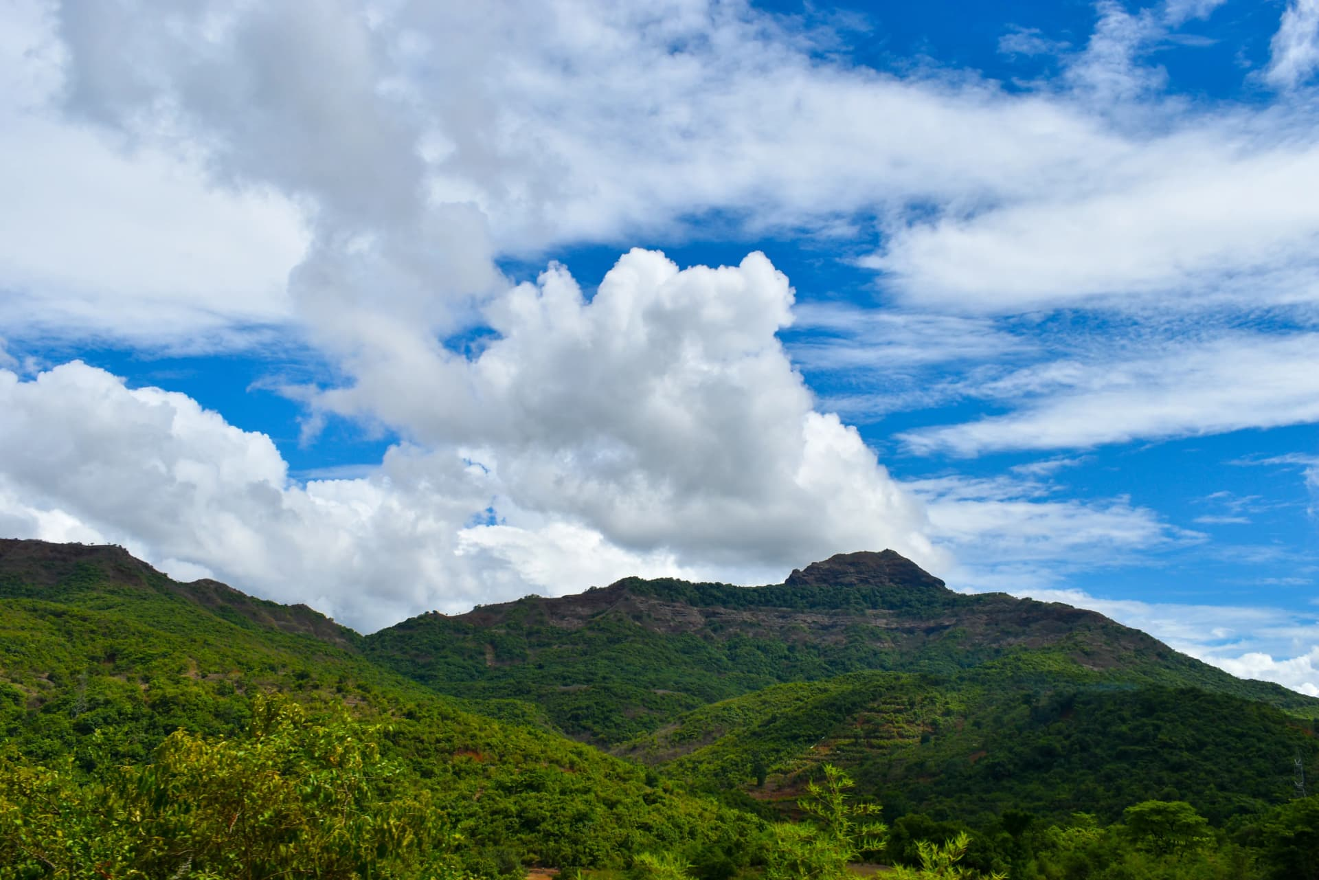
The trek starts with a gradual ascent through the rich evergreen forests of Pushpagiri Wildlife Sanctuary, one of the biodiversity hotspots of the Western Ghats. Dense tree cover, humid trails, and the sounds of birds and insects create an immersive wilderness experience. Trekkers pass through a series of forest sections that provide shade and shelter from the tropical climate. The sanctuary is home to diverse flora and fauna, including Malabar giant squirrels, hornbills, langurs, and numerous endemic bird species. The lush environment remains vibrant throughout the year, especially after the monsoon season when the forest becomes exceptionally green and alive.
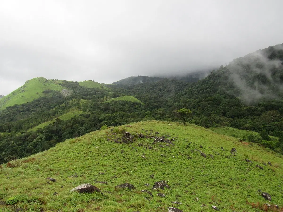
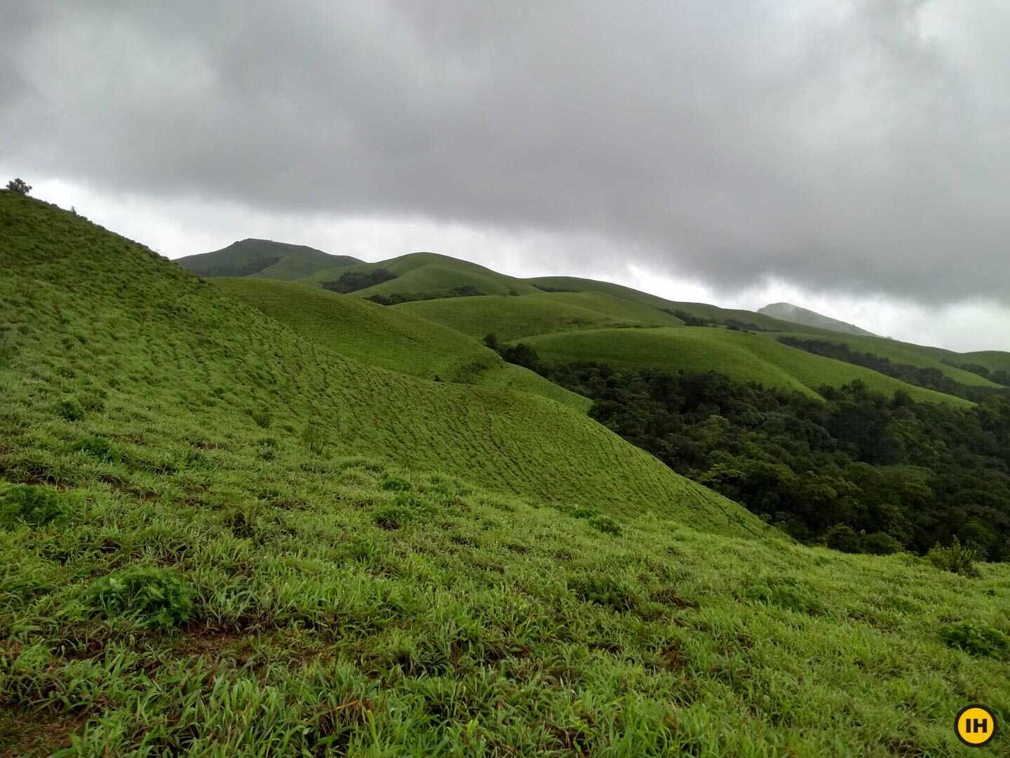
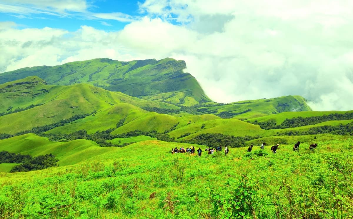
Bhattara Mane and the Expansive Grasslands
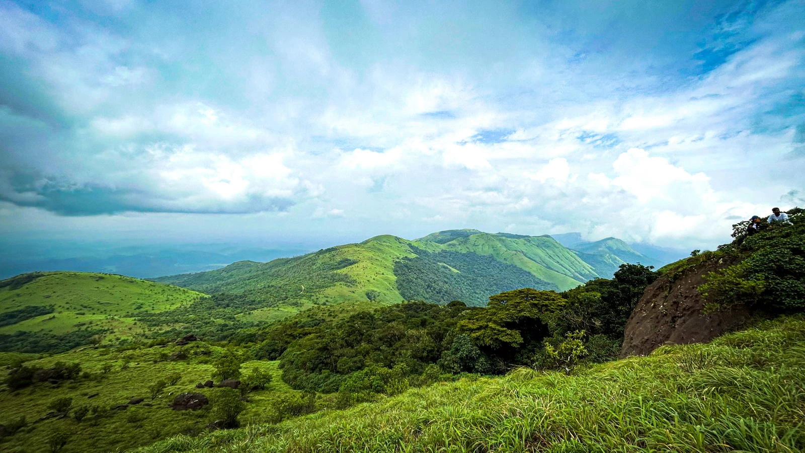
One of the most memorable landmarks on the route is Bhattara Mane, a traditional rest stop that has supported trekkers for decades. Beyond this point, the terrain changes dramatically as dense forests give way to open grasslands and rolling ridges. Trekkers are rewarded with stunning views of the surrounding valleys and mountain ranges. The exposed sections can be physically demanding under the sun, but they also provide some of the most spectacular landscapes of the trek. During sunrise and sunset, the grasslands glow with golden hues, creating unforgettable photographic opportunities.
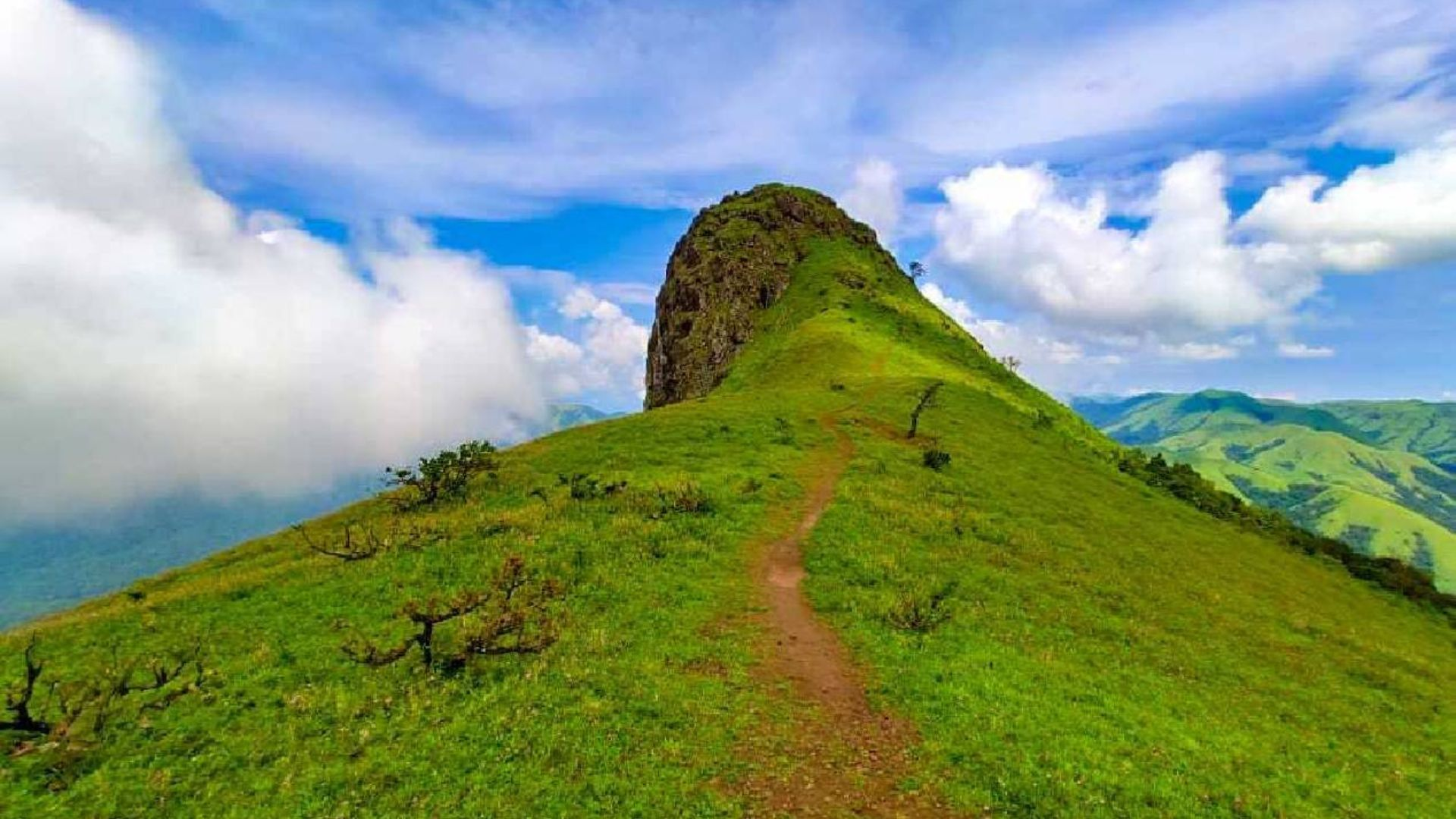
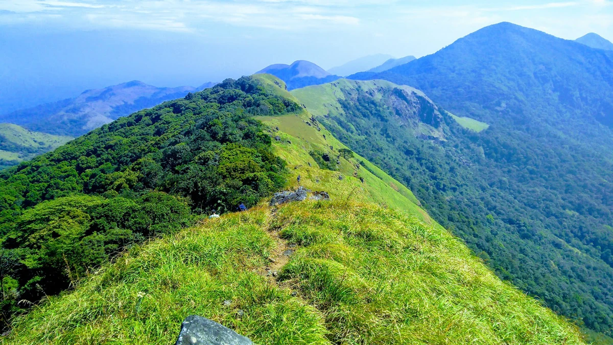
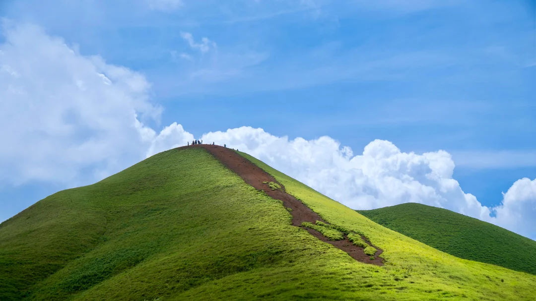
The Final Climb to Kumara Parvatha Summit
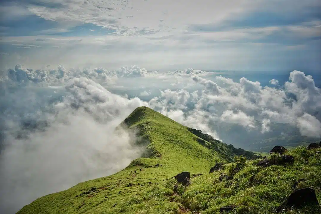
The final stretch towards Kumara Parvatha is both challenging and exhilarating. Trekkers cross steep ascents, rocky sections, and narrow ridges while gaining elevation steadily. The route passes through Shesha Parvatha, a prominent ridge that serves as an important milestone before the final summit push. As the summit approaches, panoramic views of the Western Ghats unfold in every direction. On clear days, layers of green mountains extend endlessly toward the horizon. The summit itself offers a rewarding sense of isolation and achievement rarely found on shorter treks in southern India.
Best Time to Visit and Preparation Tips
The ideal time to undertake the Kumara Parvatha Trek is between October and February when temperatures are pleasant and visibility is excellent. Monsoon trekking is generally restricted due to heavy rainfall, slippery trails, and wildlife conservation regulations. The trek is graded difficult because of its long distance, steep elevation gain, and challenging terrain. Proper physical conditioning, trekking shoes with excellent grip, adequate hydration, and sufficient energy snacks are essential. Trekkers should start early and maintain a steady pace throughout the journey. For those seeking the most demanding and scenic trekking challenge in Karnataka, Kumara Parvatha stands unmatched in terms of wilderness, difficulty, and natural beauty.