Goechala Trek

Goechala Trek

Sikkim
DifficultDifficulty
10–11 daysDuration
4600 mMax Altitude
90 kmLength
Yuksom villageStarting Point

Goechala Trek: Walking to the Foot of the Kanchenjunga Massif

The Goechala Trek is considered one of the most iconic high-altitude treks in India, not because it takes you to a summit, but because it leads you directly into the heart of the Kanchenjunga range. Located in the state of Sikkim, this trek reaches an altitude of around 4600 meters and offers some of the closest and most dramatic views of the world’s third-highest mountain. The trail moves through dense forests, alpine meadows, glacial valleys, and high-altitude viewpoints, creating a journey that feels both physically demanding and emotionally powerful. Goechala is not a fast trek. It is designed to be gradual, immersive, and deeply connected to the landscape it passes through.

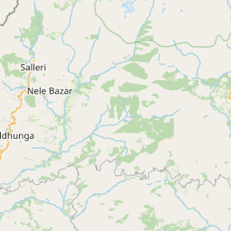
The Route and the Sacred Entry Through Yuksom

The trek begins at Yuksom, a historic village that holds great cultural significance in Sikkim. It was here that the first Chogyal of Sikkim was crowned, and the village still carries a sense of quiet reverence. From Yuksom, the trail enters the Kanchenjunga National Park, following a well-laid forest path alongside the Rathong River. The early days involve long but gentle ascents, allowing trekkers to settle into a steady rhythm. Unlike many Himalayan treks that rush toward altitude, Goechala builds slowly, with each campsite placed to support acclimatization and gradual adaptation to thinner air.

Forests, Rhododendrons, and Ecological Richness

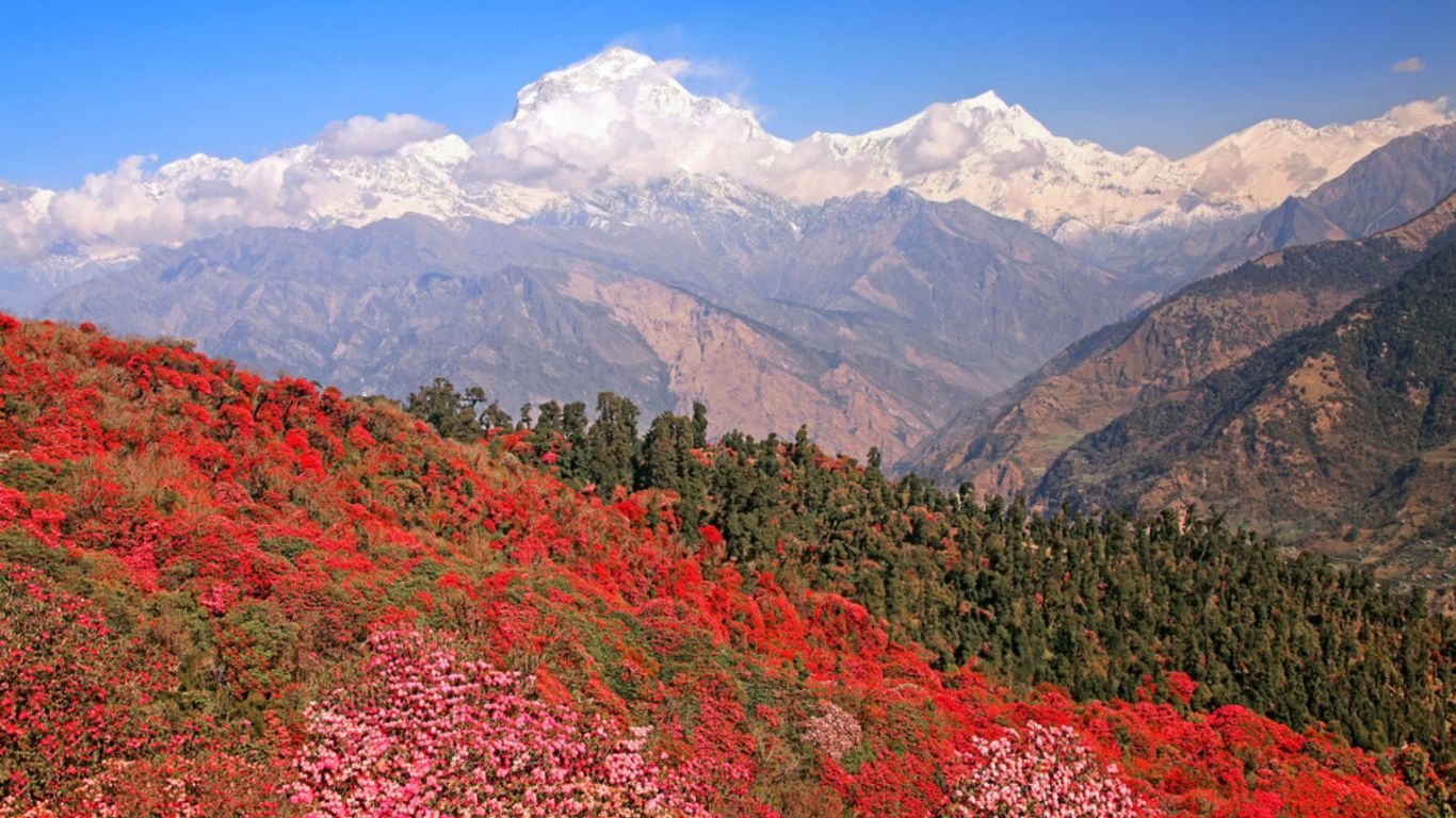
One of the defining features of the Goechala Trek is the richness of its forest sections. The lower trail passes through thick forests of oak, magnolia, and bamboo, gradually transitioning into expansive rhododendron zones. During spring, these forests bloom in shades of red, pink, and white, turning the trail into a living corridor of color. Birdlife is abundant, and the region is known for its biodiversity, including rare Himalayan flora. As altitude increases, tree cover thins, giving way to alpine shrubs and open grasslands. This steady ecological transition makes the trek visually engaging even before the high mountains come into view.

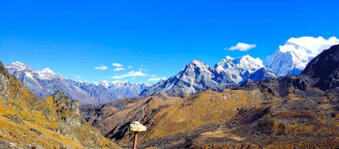
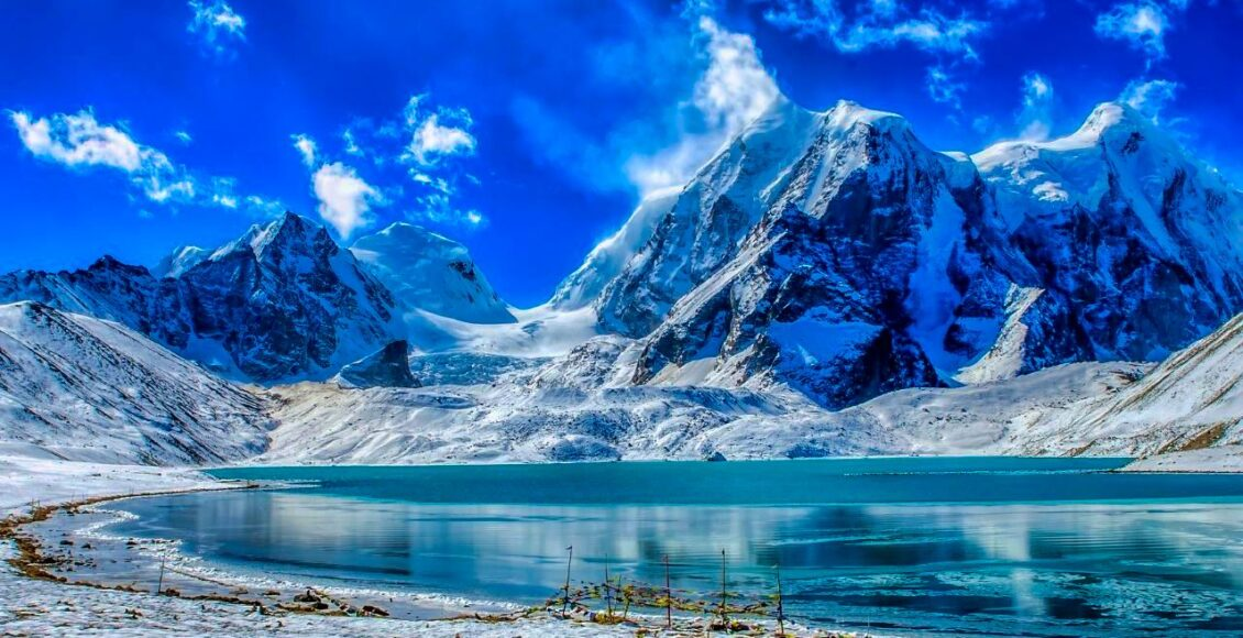
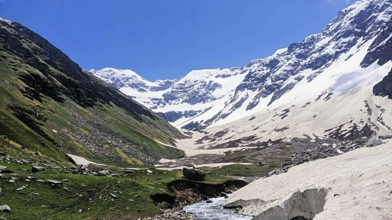
High Camps, Samiti Lake, and Mountain Drama

Beyond the forest line, the trek enters a colder and more dramatic environment. Camps such as Thansing and Lamuney sit in wide glacial valleys surrounded by towering peaks. One of the most memorable points on the route is Samiti Lake, a high-altitude glacial lake with still, reflective waters. Early mornings here are often silent, broken only by wind moving across the valley. The approach to Goechala View Point involves pre-dawn starts, frozen trails, and a gradual climb toward panoramic ridges. The terrain becomes rocky and often snow-covered in early season, demanding focus and steady movement.

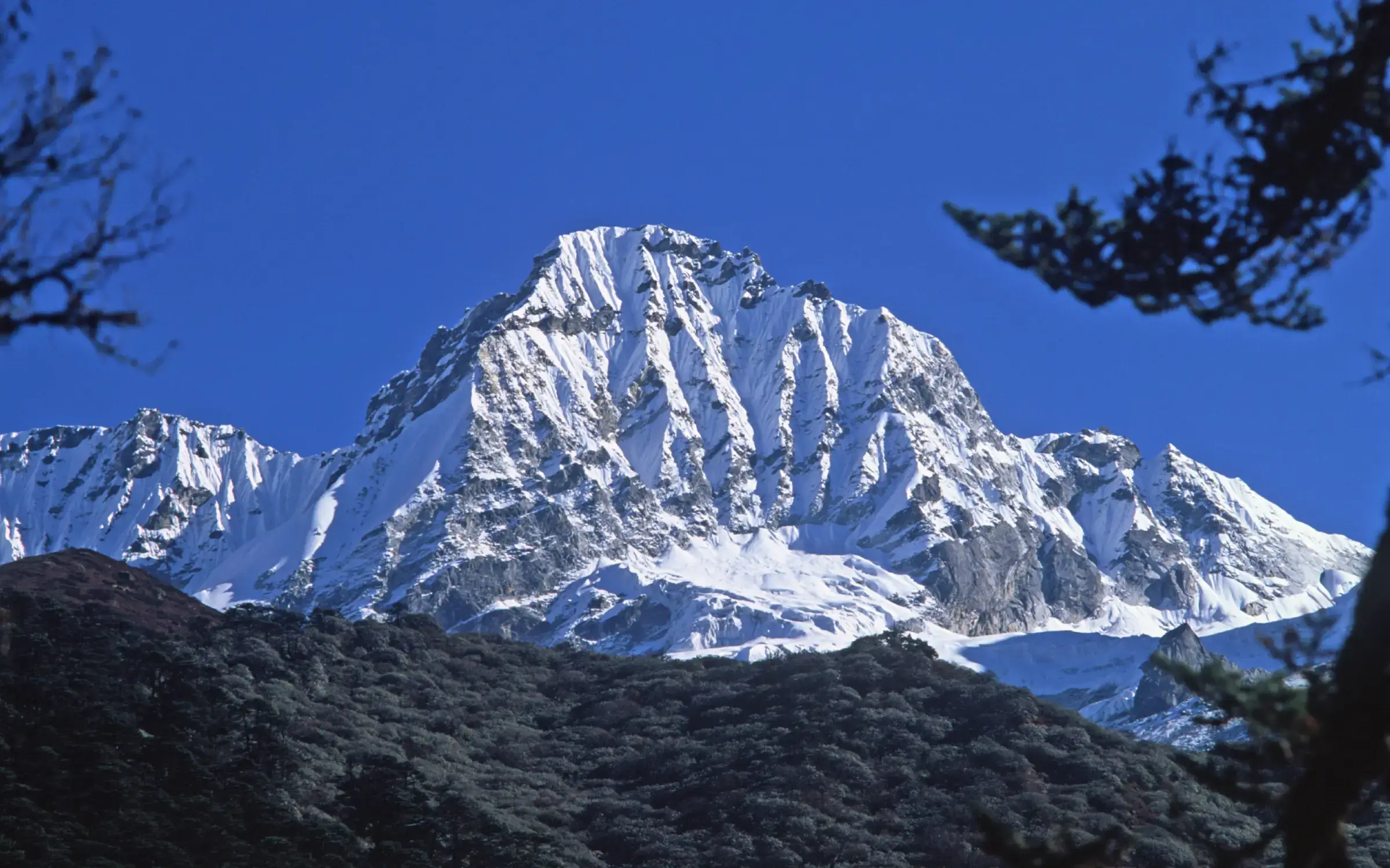
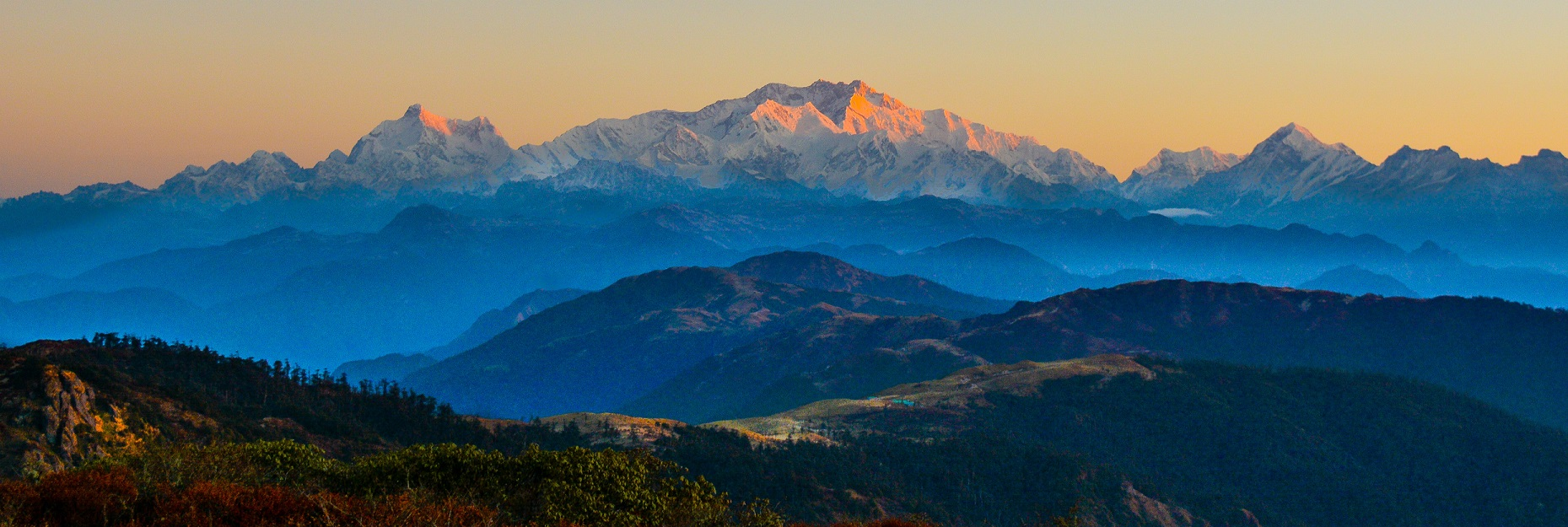
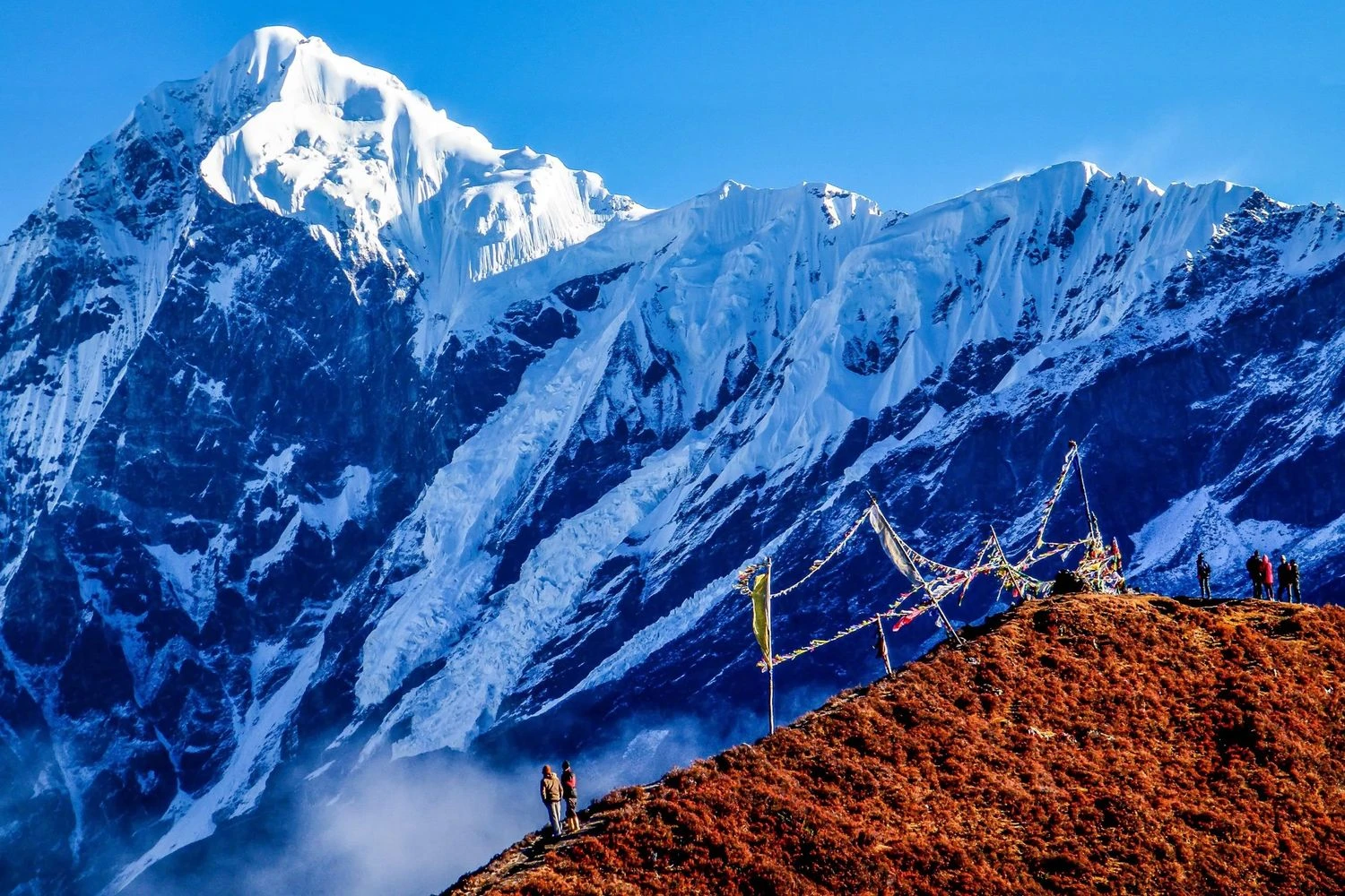
Goechala View Point and Kanchenjunga at Sunrise

The highlight of the trek is the early morning climb to Goechala View Point, where trekkers are rewarded with a direct view of the Kanchenjunga massif at sunrise. As the first light hits the peaks, the entire range shifts through shades of gold, orange, and white. Peaks such as Pandim, Kabru, and Simvo stand prominently alongside Kanchenjunga, creating a skyline that feels overwhelming in scale. This moment is not rushed. Trekkers often stand in silence, absorbing the magnitude of what lies in front of them. The experience is less about altitude and more about proximity to one of the greatest mountain systems on Earth.

Difficulty Level and Who Should Attempt Goechala

The Goechala Trek is classified as moderate to difficult. While it does not involve technical climbing, the long duration, cold conditions, and altitude make it demanding. Trekkers should have prior experience at high altitude and be comfortable walking for extended hours over multiple days. Acclimatization days are built into the itinerary, but physical fitness and mental resilience remain essential. This trek is best suited for trekkers who are not chasing speed or records, but who value depth, scenery, and the feeling of walking into a powerful mountain landscape.

Packing List

down jacket
Buy on Amazon
thermal layers
Buy on Amazon
trekking poles
Buy on Amazon
gloves
Buy on Amazon
woollen cap
Buy on Amazon
sunglasses
Buy on Amazon
sunscreen
Buy on Amazon
personal medicines
Buy on Amazon

Itinerary

Day 1: NJP to Yuksom | Distance: 150 km | Duration: 6 to 7 hours | Altitude: 5800 ft
  • Scenic drive through Sikkimese mountain roads
  • Views of rivers and forested valleys
  • Guesthouse stay with dinner
Day 2: Yuksom to Sachen | Distance: 8 km | Duration: 5 hours | Altitude: 7200 ft
  • Forest trail alongside Rathong River
  • Gradual ascent with shaded sections
  • Campsite stay with hot meals
Day 3: Sachen to Tshoka | Distance: 7 km | Duration: 5 to 6 hours | Altitude: 9800 ft
  • Steeper climb through rhododendron forests
  • First views of snow peaks near Tshoka
  • Lodge stay with warm meals
Day 4: Tshoka to Dzongri | Distance: 9 km | Duration: 6 hours | Altitude: 13100 ft
  • Open alpine trail with continuous ascent
  • Wide meadows and mountain views
  • Campsite stay with acclimatization focus
Day 5: Acclimatization at Dzongri | Distance: 4 km | Duration: 3 hours | Altitude: 13100 ft
  • Short hikes to nearby ridges
  • Rest and acclimatization
  • Second night at Dzongri camp
Day 6: Dzongri to Thansing | Distance: 10 km | Duration: 6 hours | Altitude: 12800 ft
  • Traverse through wide glacial valleys
  • Cold and open terrain
  • Campsite stay with early dinner
Day 7: Thansing to Lamuney | Distance: 4 km | Duration: 3 hours | Altitude: 13500 ft
  • Short acclimatization-focused hike
  • Cold winds and alpine surroundings
  • High camp stay
Day 8: Lamuney to Goechala View Point and back | Distance: 8 km | Duration: 7 to 8 hours | Altitude: 15100 ft
  • Early morning summit push to viewpoint
  • Snowy trail and panoramic ridge walk
  • Return to Thansing campsite

Reviews

0 reviews

Share your experience to help other trekkers plan this route.

No reviews yet for this trek.

Be the first to share what it is really like out there.

FAQs

Is Goechala Trek suitable for beginners?

No. Prior high-altitude trekking experience is recommended.

What is the highest point reached on the trek?

Goechala View Point at approximately 4600 meters.

Does the trek involve snow?

Yes. Snow is common in spring and early summer.

Is altitude sickness a concern?

Yes. Proper acclimatization is essential.

Are permits required?

Yes. Entry into Kanchenjunga National Park requires permits.

Is camping mandatory?

Yes. Campsites are used beyond Tshoka.

How cold does it get at night?

Temperatures can drop below minus 10 degrees Celsius.

Is mobile network available?

No. Network is unavailable after Yuksom.

What footwear is recommended?

Sturdy high-ankle trekking shoes suitable for snow.

What makes Goechala unique?

The close and direct view of the Kanchenjunga massif.

Mountain trail
Plan your next trek

Browse all treks in one place

Explore every trek on FindMeTrek with powerful filters for region, difficulty, duration, and season so you can quickly find the trail that matches your next adventure.

More Treks Nearby This

Other trails in this region that you might want to explore.

Essential Trekking Guidelines to Follow

Obtain Required Permits

Many trekking destinations require official permits from local authorities. Apply early to avoid fines or being denied entry.

Respect Nature and Wildlife

Follow Leave No Trace. No littering or off-trail wandering. Keep noise low and avoid disturbing animals.

Travel with a Guide when Required

Certain high-altitude or border zones mandate certified guides for safety and regulations. Check rules before planning.

Camp Only at Designated Sites

Unauthorized camping or bonfires can damage ecosystems and violate laws. Use approved campsites for safety.

Respect Local Culture

Seek permission before photographing villagers or holy places. Dress modestly and engage respectfully with locals.

Follow Weather and Safety Advisories

If authorities halt a trek due to weather or hazards, comply without argument. These alerts protect lives.

Stay Within Allowed Zones

Border-close trails often have restricted limits. Do not cross protected boundaries without permissions.

Stick to Group Instructions

When trekking with a group, follow the leader’s pace and timing. Avoid moving alone or straying off track.