Ettina Bhuja Trek
Home/Treks/Ettina Bhuja Trek
Easy

Ettina Bhuja Trek

Karnataka, India
Starting from
--
per person
0 operators available
Duration1 Day
Max Altitude1300 m
Trek Distance10 km
Starting PointShishila

Itinerary

Day1

Shishila Base to Ettina Bhuja Summit and Return

10 km
5-6 hours
1300 m

Begin trekking from the trailhead near Shishila village.

Walk through forest sections and gradual uphill trails.

Enter open grasslands with panoramic views of the surrounding hills.

Follow the ridgeline toward the summit of Ettina Bhuja.

Enjoy expansive views of the Western Ghats before descending.

Return to the base and conclude the trek.

Packing List

Ettina Bhuja Trek: Hike to the Ox’s Shoulder in the Western Ghats

Ettina Bhuja Trek is one of Karnataka's most underrated trekking experiences, offering spectacular views of the Western Ghats without the crowds often found on more famous trails. Located in the Chikkamagaluru district near Mudigere, the trek derives its name from the Kannada words meaning "Ox's Shoulder," a reference to the mountain's distinctive shape. Rising to approximately 1,300 meters above sea level, Ettina Bhuja provides a rewarding combination of forest trails, open grasslands, ridge walks, and panoramic mountain scenery. The trek is ideal for beginners and experienced trekkers alike, offering an accessible yet highly scenic adventure in one of South India's most biodiverse regions.

A Hidden Gem in the Western Ghats

Unlike heavily visited trekking destinations, Ettina Bhuja retains a peaceful and relatively untouched atmosphere. The trail begins near Shishila village and gradually ascends through forests and grass-covered slopes. The route passes through landscapes typical of the Western Ghats, including evergreen vegetation, mountain streams, and open ridges. The quieter nature of the trek allows visitors to fully appreciate the sounds and scenery of the surrounding wilderness.

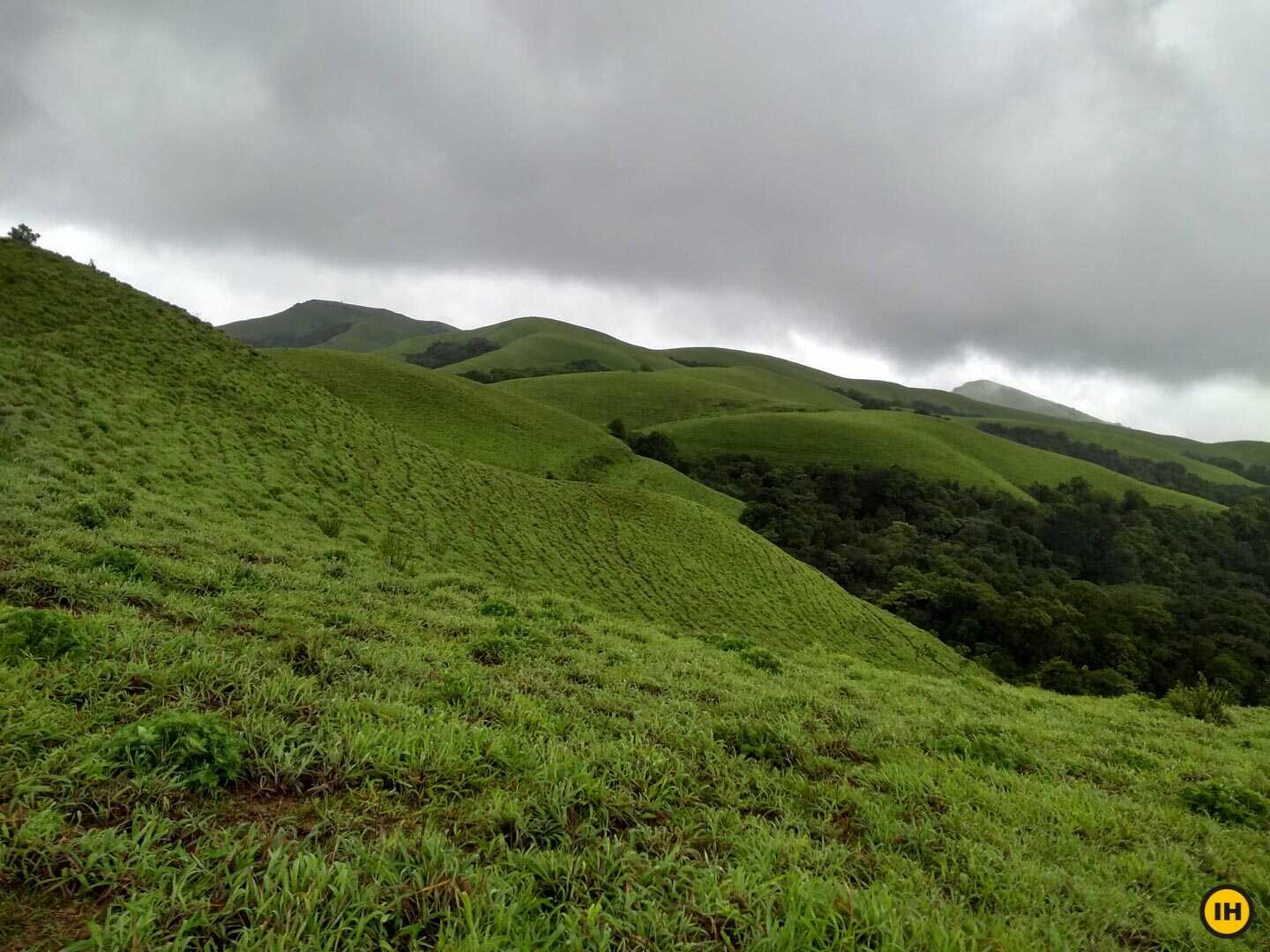
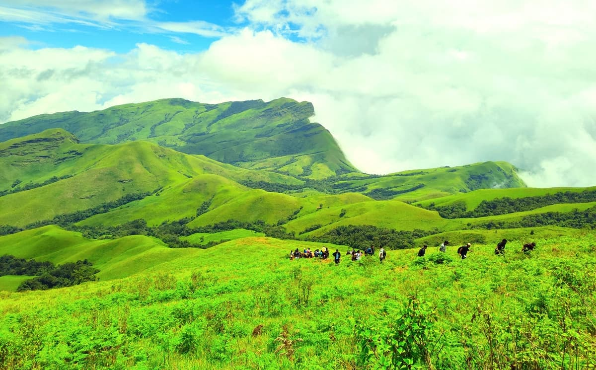
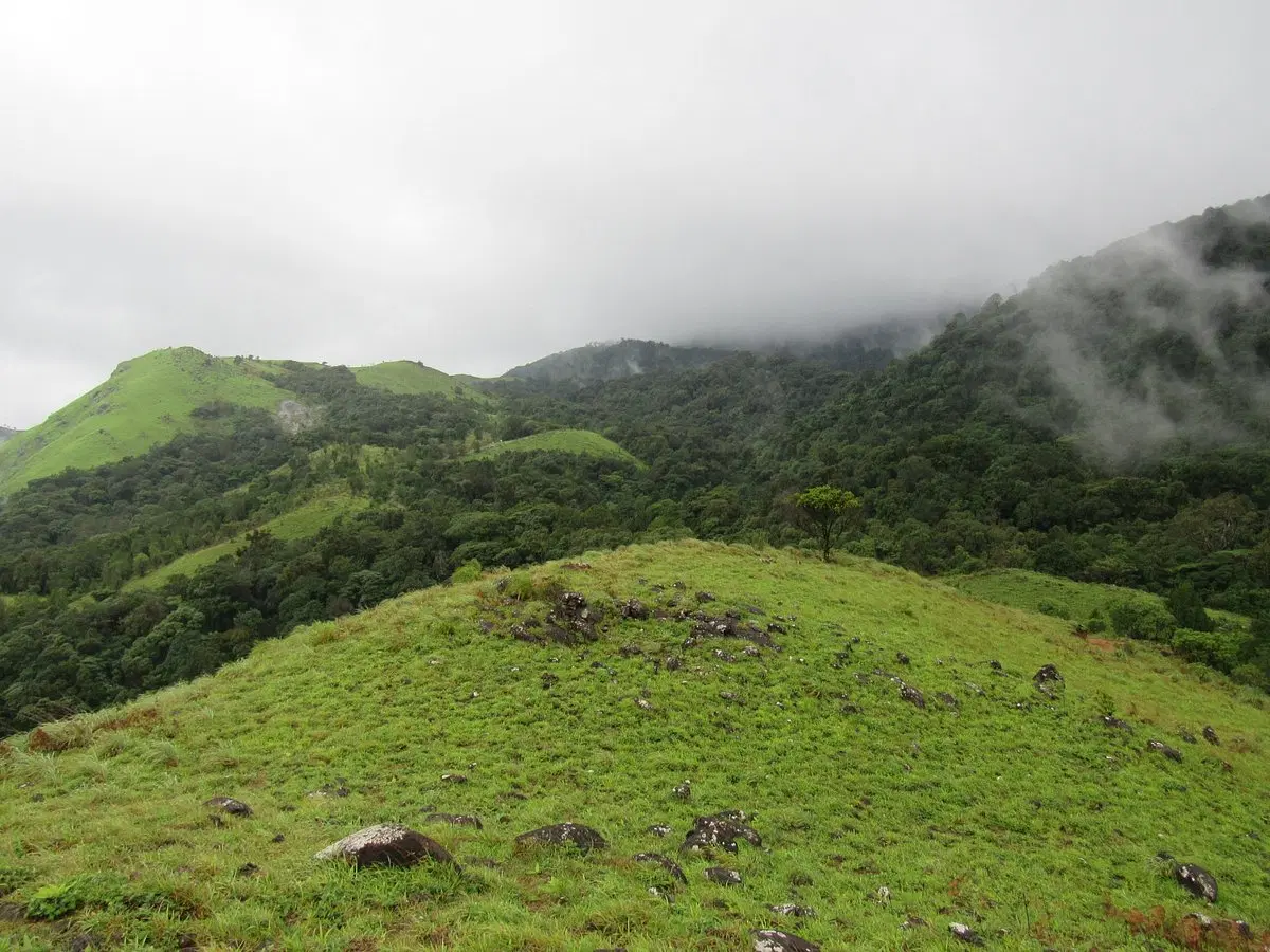
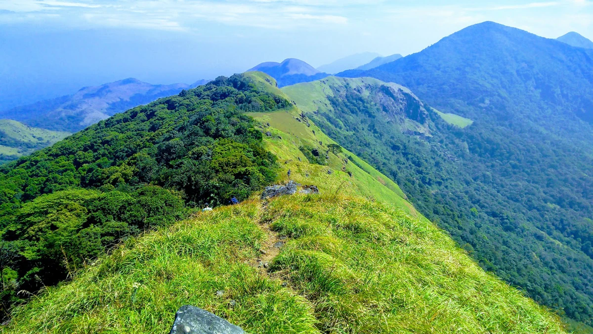
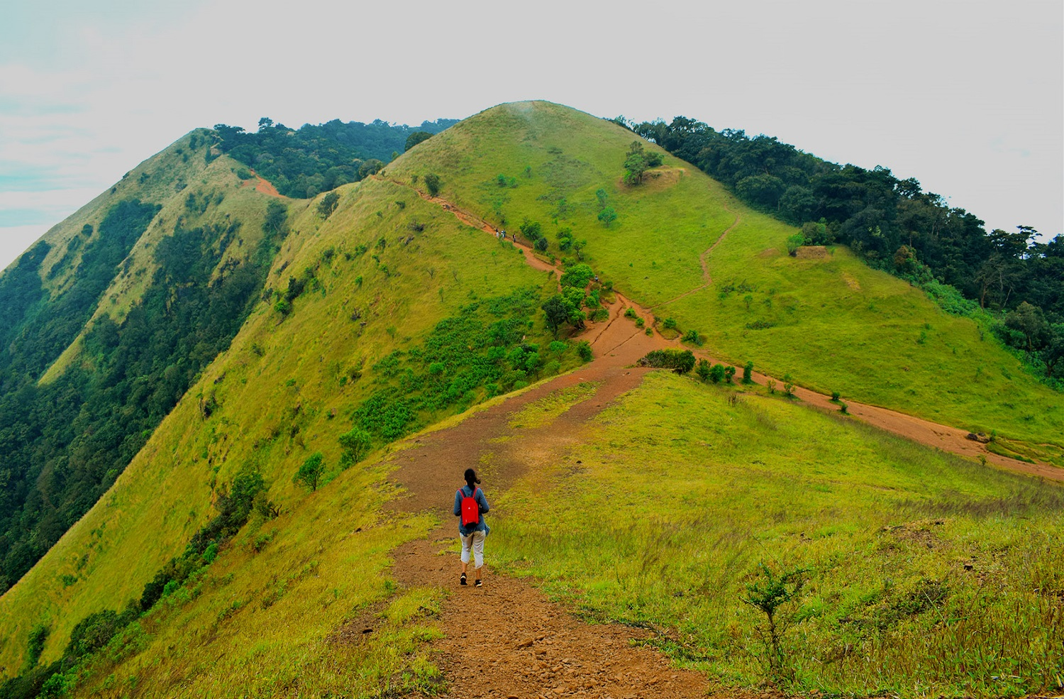
Grasslands and Ridge Walks

One of the defining features of the trek is its scenic grassland sections. As trekkers gain altitude, the forest opens into rolling meadows that provide uninterrupted views of the surrounding mountains. The ridgeline walk near the summit is particularly memorable, offering breathtaking vistas of neighboring peaks, valleys, and forested landscapes. During the post-monsoon season, the hills become lush green and create ideal conditions for photography.

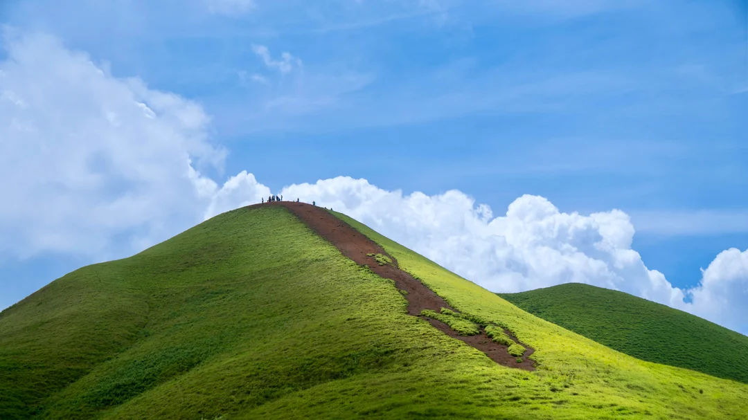
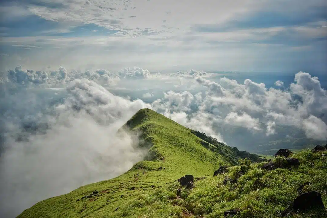
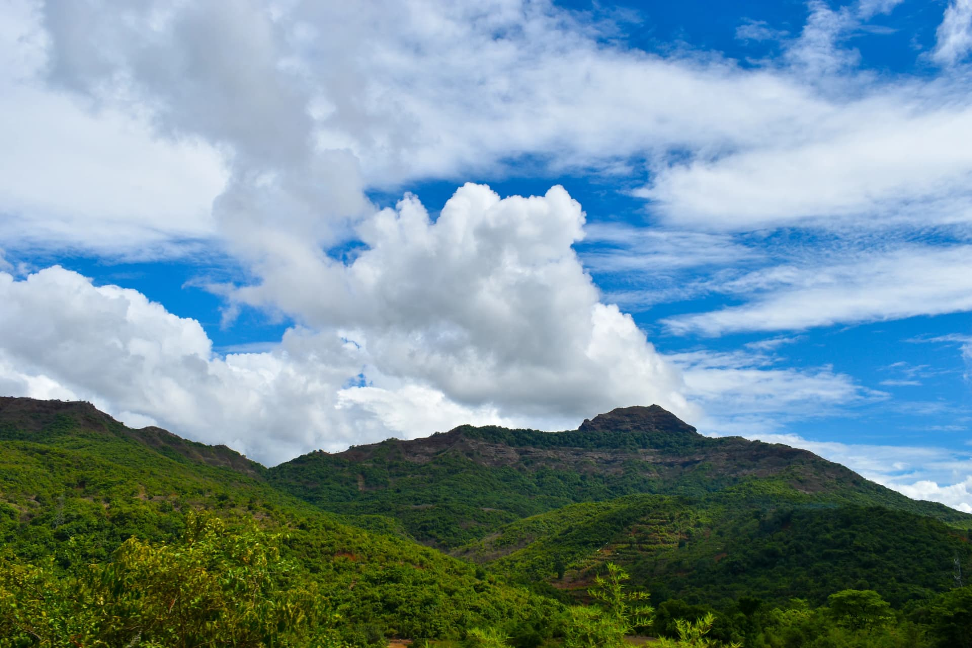
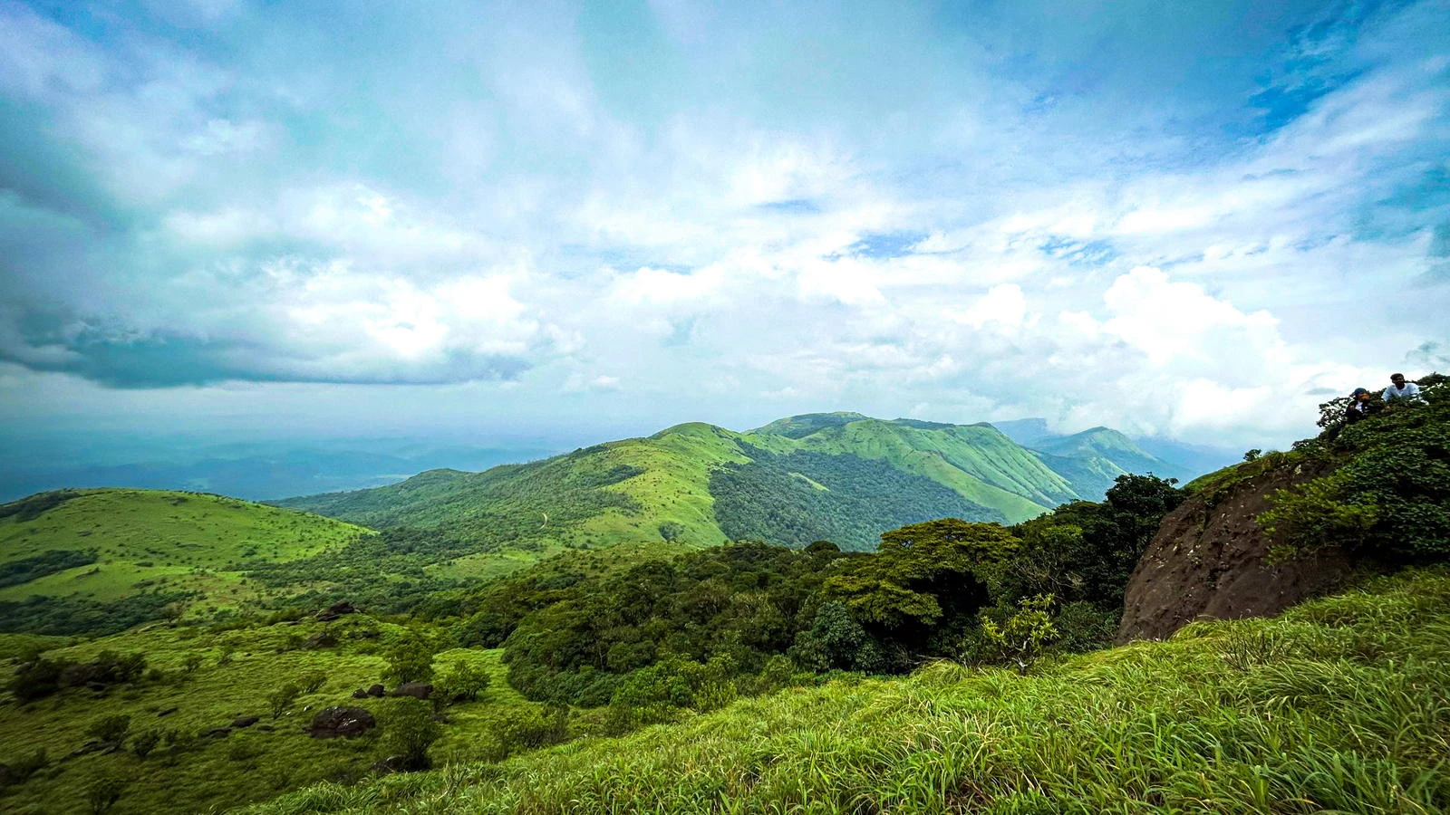
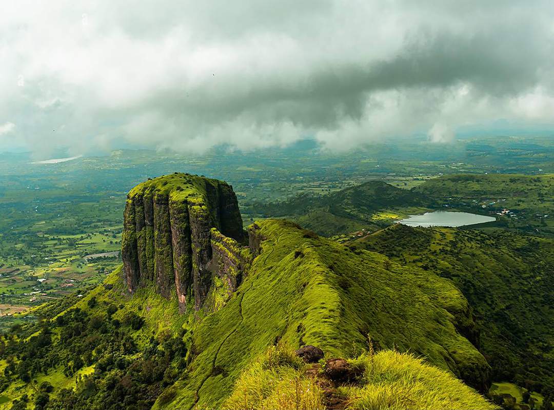
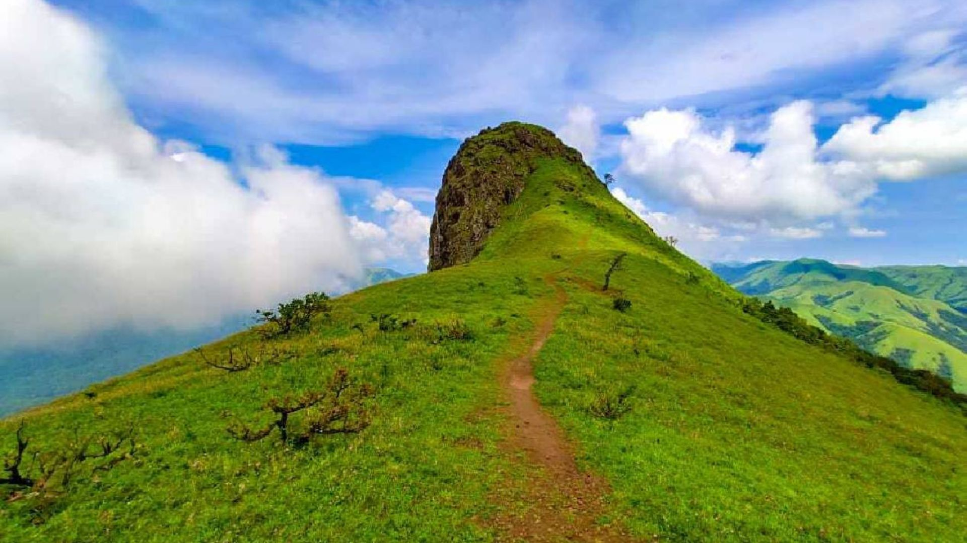
Views Across the Western Ghats

The summit area of Ettina Bhuja offers panoramic views extending across the Western Ghats. On clear days, trekkers can observe mountain ranges stretching toward the horizon, while drifting clouds add drama to the landscape. The peak's unique shape and elevated position make it one of the most photogenic trekking destinations in the region. The relatively moderate altitude ensures a comfortable trekking experience throughout most of the year.

Why Ettina Bhuja Is Worth Exploring

Ettina Bhuja combines scenic beauty, accessibility, and solitude into a single trekking experience. The route is challenging enough to feel rewarding while remaining suitable for most trekkers with basic fitness. Its grasslands, ridgelines, forest sections, and mountain views showcase the best of the Western Ghats. For those looking to discover a lesser-known trekking destination in Karnataka, Ettina Bhuja offers an unforgettable adventure away from the crowds.

Best Month to Visit

Best
Moderate
Avoid

Nearest airport

Mangaluru International Airport

Nearest railway

Sakleshpur Railway Station

Friday 12 Jun
Start point19° / 23°
Drizzle
23°
06:00
18:53
96%
Summit20° / 24°
Drizzle
24°
06:00
18:53
96%
Hourly temperature°C
Main trek location
Starting point

Frequently asked questions

Everything you need to know about this trek, including route conditions, transport, preparation, weather, permits, and trekking difficulty.

Ettina Bhuja stands at approximately 1,300 meters above sea level.

The name means "Ox's Shoulder" in Kannada and refers to the mountain's distinctive profile.

The trek is generally rated easy to moderate and is suitable for beginners with reasonable fitness.

The standard round-trip trek covers approximately 10 kilometers.

October to February provides clear skies, comfortable temperatures, and excellent visibility.

Yes, but heavy rain, slippery trails, and leeches can make the trek more demanding.

Access regulations occasionally change, so trekkers should verify current forest department requirements.

The surrounding forests support birds, butterflies, Malabar giant squirrels, and other Western Ghats species.

Yes. It is considered one of the more beginner-friendly summit treks in Karnataka.

The scenic ridgelines, grasslands, dramatic cloud formations, and panoramic mountain views create excellent photography opportunities.

Mountain trail

Browse all treks in one place

Discover trekking routes across India with filters for duration, weather, difficulty, altitude, and season.

20+
Regions
100+
Treks
All Seasons
Year Round
Trek smarter

Compare weather, route conditions, transport access, and difficulty.

More Treks Nearby This

Explore all treks
Trek Safety & Etiquette

Essential trekking guidelines

Responsible trekking protects mountains, wildlife, local culture, and your own safety. Follow these guidelines before heading into the trails.

Obtain Required Permits

Many trekking destinations require official permits from local authorities. Apply early to avoid fines or denied entry.

Respect Nature and Wildlife

Follow Leave No Trace. Avoid littering, loud noise, and disturbing wildlife or fragile vegetation.

Travel with a Guide

Some high-altitude and border routes legally require certified guides for navigation and safety.

Camp at Approved Sites

Unauthorized camping and bonfires can damage ecosystems and may violate local regulations.

Respect Local Culture

Dress respectfully, ask before photographing locals, and honor regional customs and sacred places.

Follow Weather Advisories

If authorities halt trekking due to weather or hazards, comply immediately for your safety.

Stay Within Allowed Zones

Do not cross restricted or protected boundaries without official permissions.

Follow Group Instructions

Stay with your group, maintain pacing discipline, and avoid trekking alone on unknown trails.