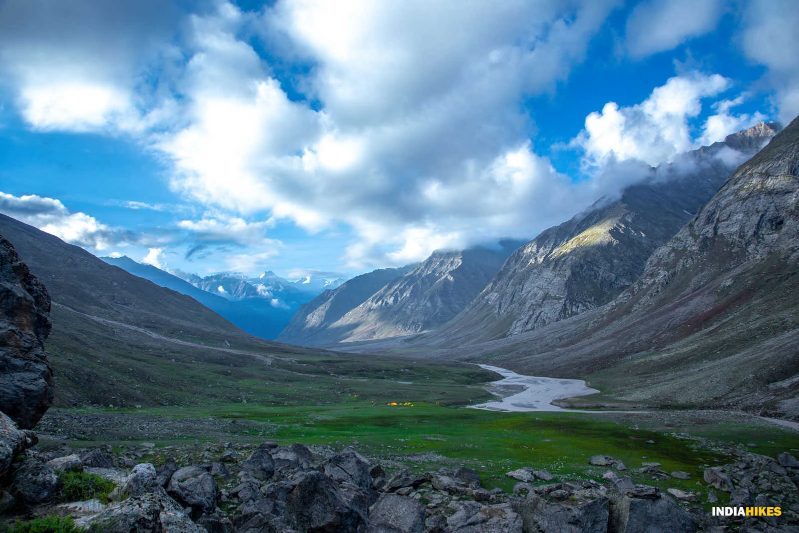
Miyar Valley Trek

Miyar Valley Trek

Himachal Pradesh
DifficultDifficulty
7-9 daysDuration
3950 mMax Altitude
75 kmLength
Udaipur VillageStarting Point

Miyar Valley Trek: The Yosemite of the Himalayas

The Miyar Valley Trek, located in the remote Lahaul region of Himachal Pradesh, is often called the "Yosemite of India" for its endless alpine meadows, wildflowers, and towering granite cliffs. Unlike the crowded trails of Himachal, Miyar Valley remains relatively unexplored, offering trekkers solitude and raw Himalayan beauty. At 12,959 ft, the valley culminates near Kang La Pass, providing mesmerizing views of snow peaks and glaciers. Its gentle gradient makes it accessible to beginners, while its vast landscapes attract seasoned trekkers and photographers.

The Valley of Flowers of Lahaul

During summer, Miyar Valley blooms with hundreds of species of wildflowers, earning it comparisons to the famous Valley of Flowers in Uttarakhand. The meadows stretch endlessly, with streams crisscrossing the trail, creating postcard-perfect landscapes.

Trail and Cultural Experience

Starting from Udaipur village, the trek moves along the Miyar River, passing through remote villages like Shukto and Thanpattan. Trekkers interact with local Lahauli people, experience their unique Tibetan-influenced culture, and camp in wide alpine pastures under starry skies.

Highlights of the Trek

- Expansive meadows dotted with wildflowers
- Views of granite cliffs and snow-capped peaks
- Remote Himalayan villages and Tibetan culture
- Comparisons to Yosemite Valley for its dramatic landscapes
- Gentle trail suitable for both beginners and seasoned trekkers

Packing List

Itinerary

DAY 1
Arrival in Manali, drive to Udaipur
📏 150 km⏱ 7-8 hours drive⛰ 8,000 ft
DAY 2
Udaipur to Shukto, trek to Thanpattan
📏 12 km⏱ 5-6 hours⛰ 10,000 ft
DAY 3
Thanpattan to Zardung
📏 12 km⏱ 5-6 hours⛰ 11,500 ft
DAY 4
Zardung to Kesar Yon Chhap
📏 13 km⏱ 6-7 hours⛰ 12,500 ft
DAY 5
Kesar Yon Chhap to Kang La base
📏 10 km⏱ 5-6 hours⛰ 12,959 ft
DAY 6
Exploration at Kang La base, return to Kesar Yon Chhap
📏 10 km⏱ 5-6 hours⛰ 12,959 ft
DAY 7
Kesar Yon Chhap to Shukto, drive to Udaipur
📏 25 km trek + drive⏱ 6-7 hours⛰ 8,000 ft
DAY 8
Udaipur to Manali
📏 150 km⏱ 7-8 hours drive⛰ 6,700 ft
Main trek location
Starting point

Best Month to Visit

Best
Moderate
Nearest airportBhuntar Airport
Nearest railwayJoginder Nagar Railway Station

Weather along your trek

Loading weather data

Pricing

Fetching latest prices