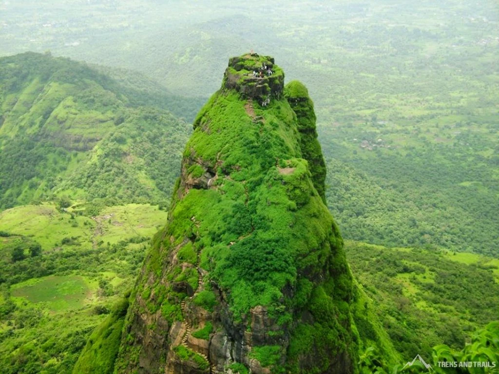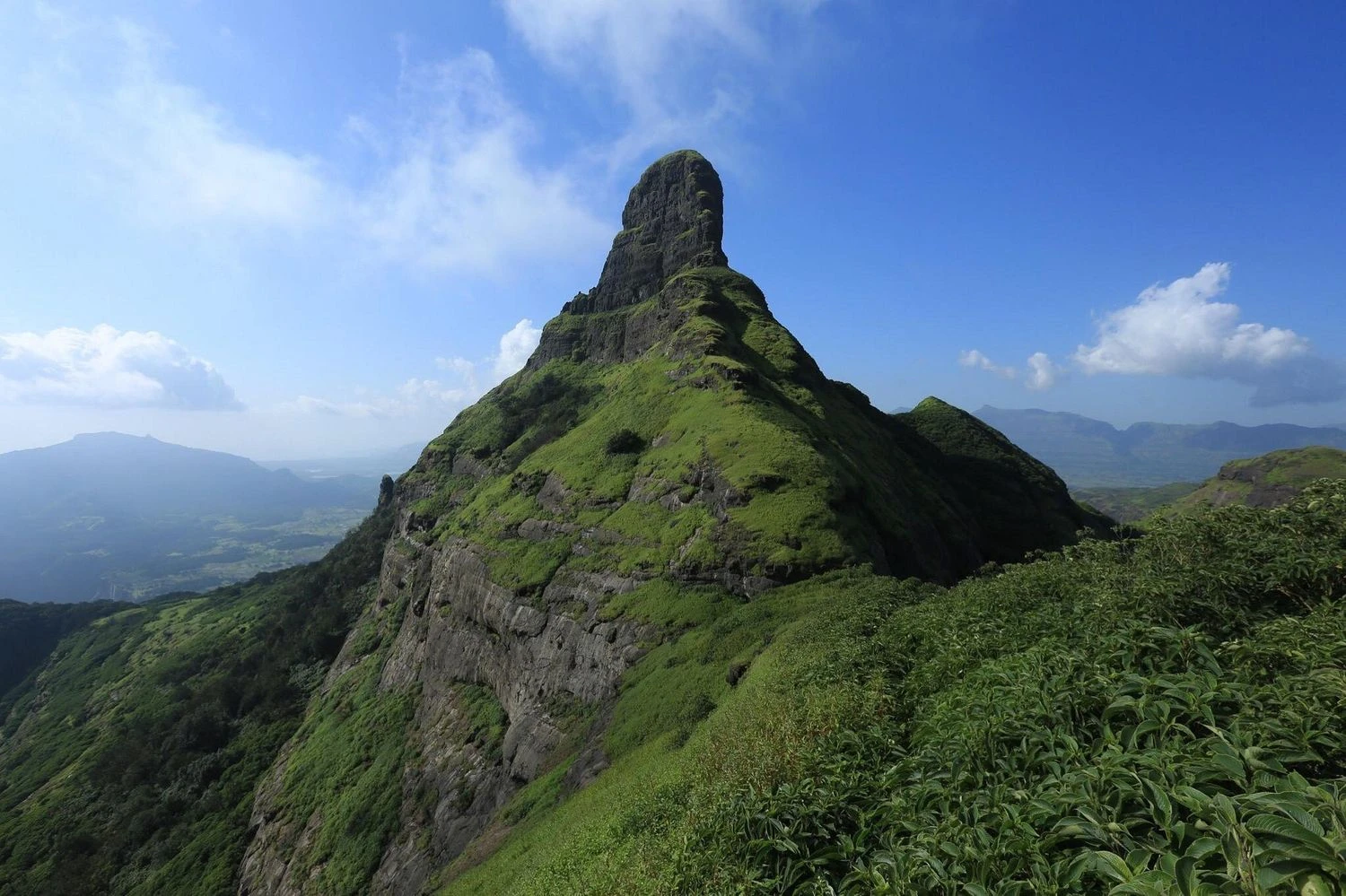


Tung Fort Trek: Climb the Needle-Shaped Watchtower of Pawna Lake
The Tung Fort Trek is one of the most scenic and rewarding short treks in the Sahyadri range of Maharashtra. Located near Lonavala and overlooking the vast backwaters of Pawna Lake, Tung Fort stands atop a narrow conical hill that rises dramatically from the surrounding landscape. Known historically as Kathingad, the fort served as an important watchtower during the Maratha period due to its strategic position overlooking trade routes and nearby forts. Despite its relatively small size, Tung Fort offers a thrilling trekking experience with steep ascents, rocky pathways, and breathtaking views of the surrounding valleys. The trek is particularly popular among weekend trekkers from Mumbai and Pune because it combines history, adventure, and spectacular scenery in a compact day hike. During the monsoon season, the fort becomes surrounded by lush green hills, mist-covered ridges, and overflowing waterfalls, transforming the entire region into one of the most picturesque landscapes in the Western Ghats.
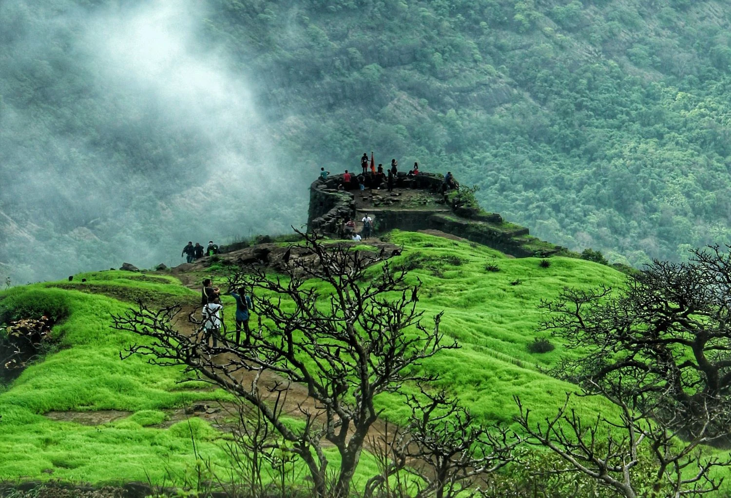
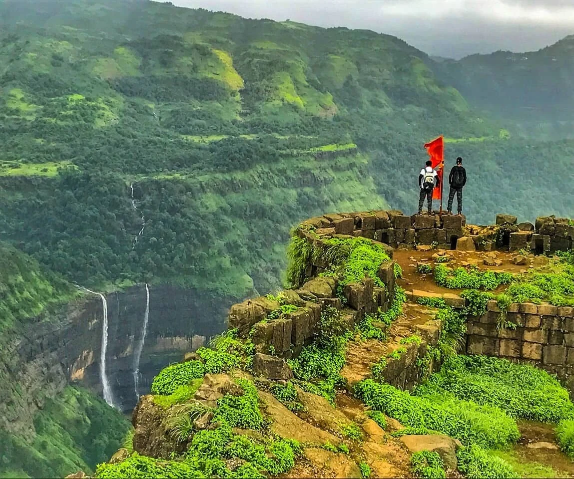
A Historic Fort with Strategic Importance
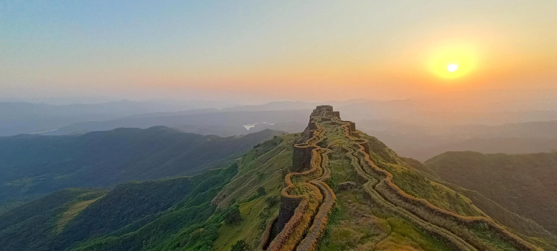
Tung Fort was built before the rise of the Maratha Empire and later came under the control of Chhatrapati Shivaji Maharaj. Its elevated location made it an ideal watchtower for monitoring movement through the Maval region. Although the fort itself is relatively small compared to larger Sahyadri forts, its strategic significance was considerable. Today, trekkers can explore remnants of fort walls, bastions, gateways, and water cisterns that provide glimpses into its military history. The narrow summit ridge adds to the fort's distinctive appearance and creates a unique trekking experience unlike many other forts in Maharashtra.
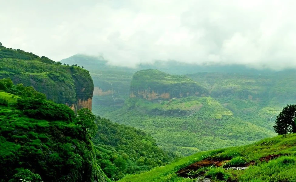
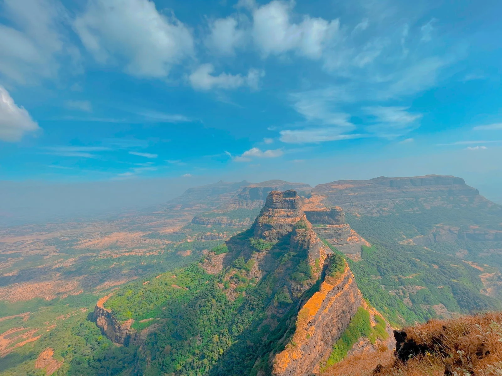
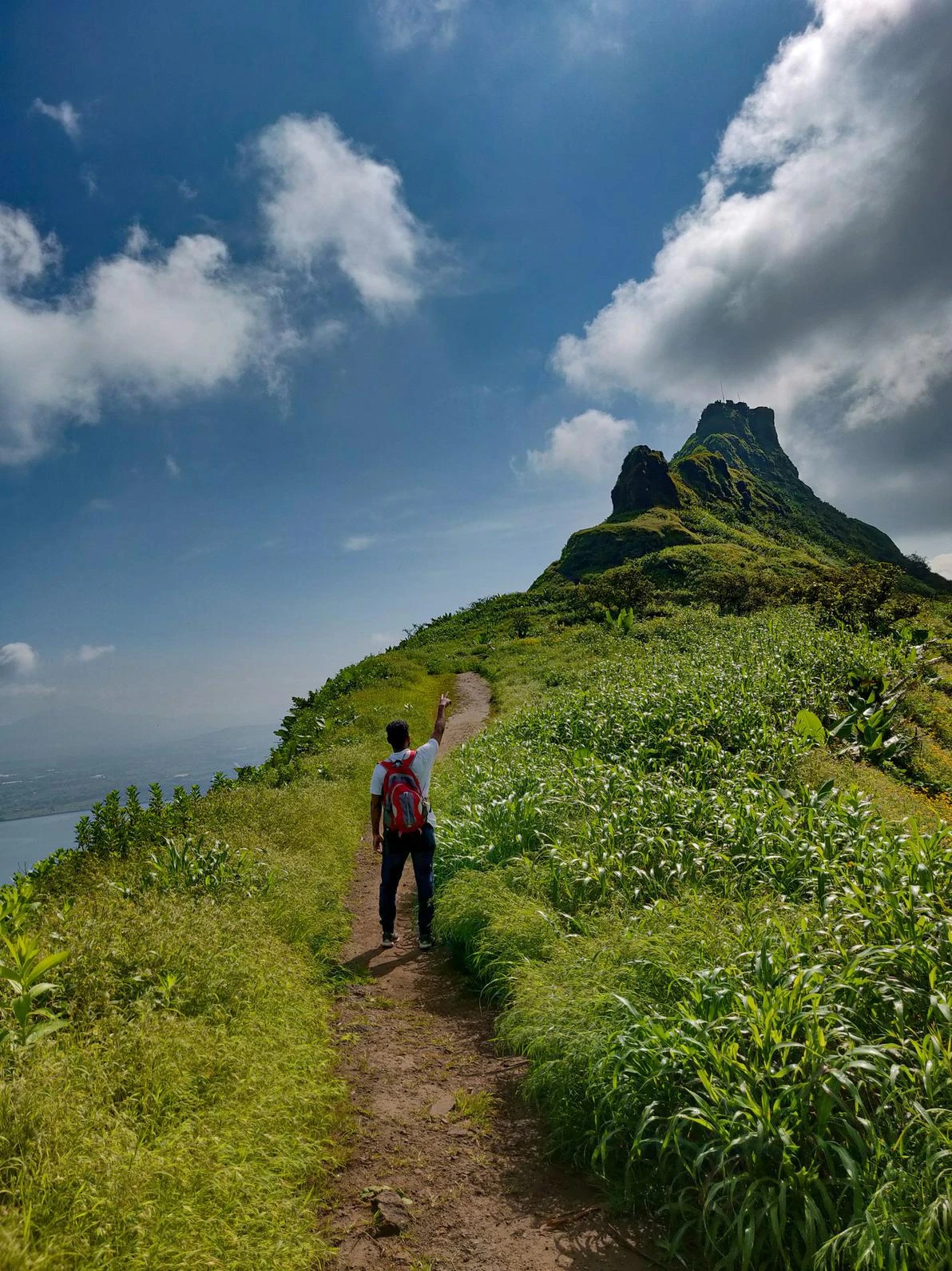
The Scenic Climb Above Pawna Lake
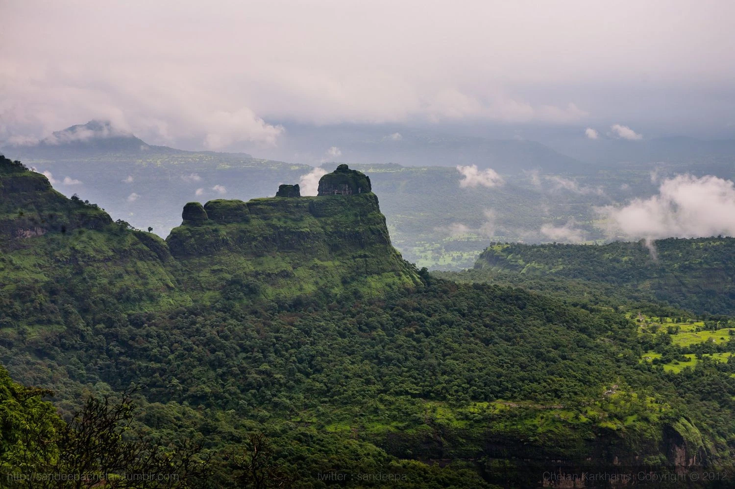
The trek begins from Tungwadi village and gradually ascends through open slopes and rocky pathways. As trekkers gain altitude, panoramic views of Pawna Lake begin to unfold. The surrounding landscape is dominated by rolling Sahyadri hills, agricultural fields, and several historic forts visible in the distance. The trail becomes steeper near the summit, requiring careful footing but remaining manageable for most trekkers. During monsoon months, clouds frequently sweep across the ridges, creating dramatic scenery and offering countless photography opportunities.
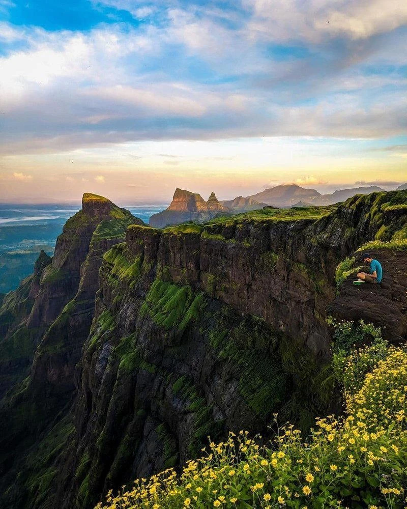
Summit Views and Nearby Landmarks
The summit of Tung Fort provides one of the finest viewpoints in the Pawna region. Trekkers can enjoy panoramic views of Pawna Lake, Tikona Fort, Lohagad Fort, Visapur Fort, and the surrounding valleys. The narrow ridge at the top creates an exhilarating sense of elevation while offering unobstructed views in every direction. Early morning treks are particularly rewarding as sunrise illuminates the surrounding landscape with golden light. The combination of water bodies, mountains, and historic landmarks makes the summit a favorite destination for photographers and nature enthusiasts.
Best Time to Visit and Trek Preparation
The best time to undertake the Tung Fort Trek is from June to February. Monsoon months transform the region into a lush green paradise, while winter provides clear skies and comfortable temperatures. The trek is graded easy to moderate and is suitable for beginners with basic fitness levels. However, caution is necessary during monsoon because the rocky sections near the summit can become slippery. Carrying proper trekking shoes, rain protection, drinking water, and light snacks is recommended. For those seeking a short yet rewarding trek near Mumbai or Pune, Tung Fort offers a perfect combination of history, scenery, and adventure.